ProjectsA detached house, permit and working drawings
A building permit in Bavaria
A detached house of 11 × 9 m with a basement and a garage on the boundary, on a 429 m² plot. Eight sheets for the permit, then the same model carried on to working drawings at 1:50 and a detail at 1:20.
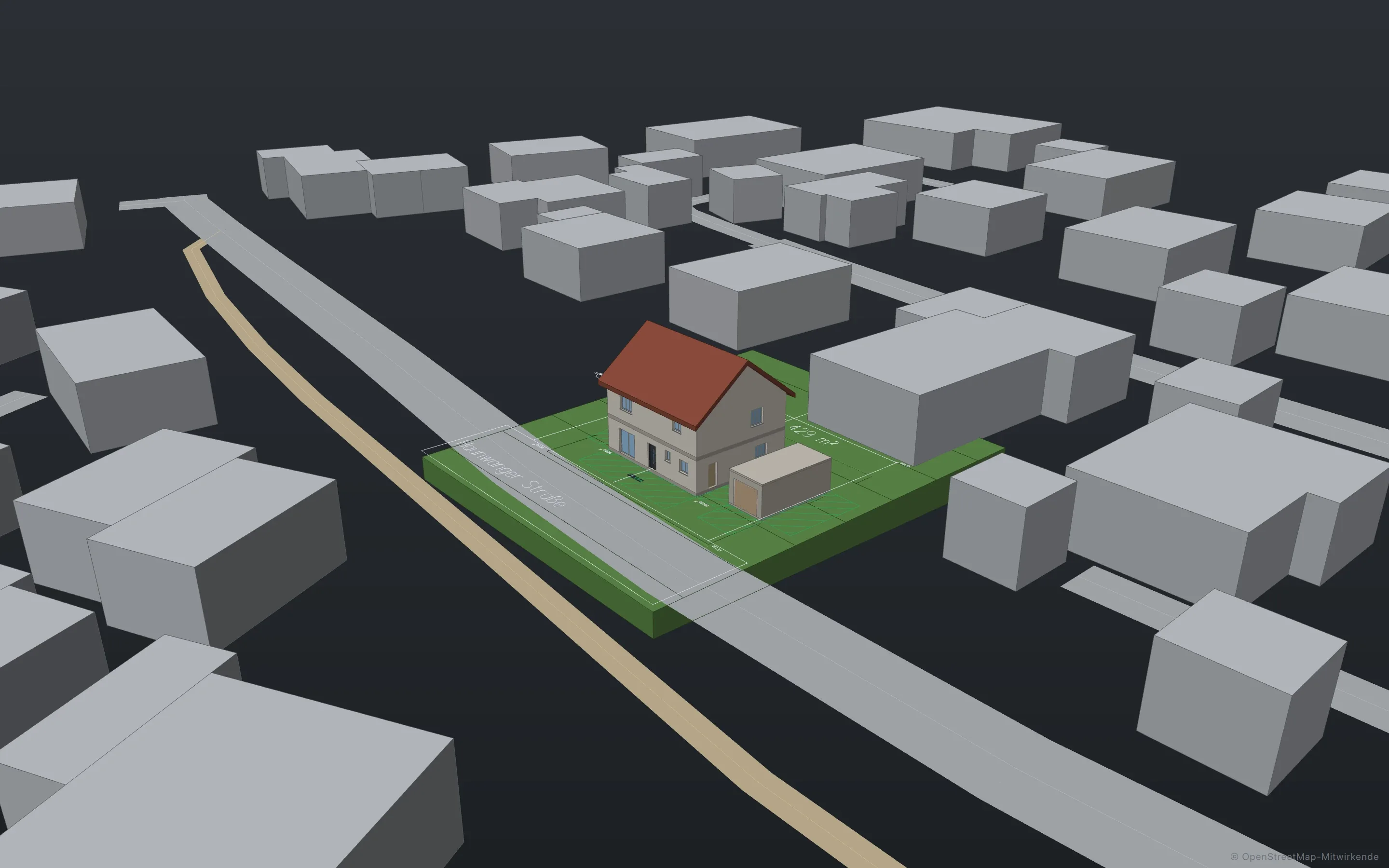
- Plot
- 429 m²
- House
- 11 × 9 m
- Roof pitch
- 38°
- Permit sheets
- 8
- Working drawings
- 7
A click opens the whole sheet for zooming. The sheets are labelled in German, as the project is.
Site plan with neighbours
The plot is made up; the neighbouring buildings come from OpenStreetMap. The site plan shows north arrow, setback areas, distances and the height above datum.
Plans, section, elevations
At 1:100, and the section labels itself: clear heights, the stair with its risers, wall height, roof pitch. The elevations name the materials of their faces. Plus a sheet of calculations and the building description.
On to working drawings
The same house at 1:50: structural dimensions, openings with sill heights, layers hatched by material, build-ups on leaders. The eaves detail is a cut-out of the model.
Built with
The project is a script of Linework commands. These are the main ones.
surroundingssetbacksmassinglevelplanssectionelevationdimwallsnortharrowpositionsscheduleplotWhat the project showed
A whole project finds errors that one example per command does not.
Found and closed
- Sections and elevations showed the whole surroundings and fitted on no sheet. Now there is cropping.
- The north arrow was missing, and elevations were named after the drawing’s axes instead of the compass.
- On the round trip through IFC the neighbours’ houses sat on the ground floor as building parts. Now they are part of the site.
Open
- Permit forms stay out on purpose. The building description exists as text with fields.
- The official cadastral map is not free in Bavaria. It comes in as DXF or PDF from the surveying office.
- The detail still lacks dimensions and labels.
Download the drawings
Plot, parcel number, development plan and client are made up. Neighbouring buildings and street: © OpenStreetMap contributors.
Download Linework and open one of your drawings.
The app is free, for professional work too, without an account or a licence key.
- Product
- FrameMind Linework
- Version
- 0.19.2
- Date
- 13 November 2026
- Platform
- macOS, Apple silicon
- Windows
- in preparation
- Price
- free